Cape Town: A Cape Town weather warning has placed the city on high alert before Sunday’s cold front, with the South African Weather Service issuing a Yellow Level 4 warning for disruptive rain and further Yellow Level 2 warnings for damaging winds and damaging waves. The warning matters because 30mm to 60mm of rain could fall over Cape Town and the Cape Winelands, while rough seas between Cape Columbine and Cape Agulhas could make coastal conditions dangerous from Sunday into Monday. The City of Cape Town says its Disaster Risk Management Centre, municipal services and external partners are on standby, but Capetonians are being urged to prepare homes, roads, drains, roofs, informal structures and Monday travel plans before the system arrives.
SAWS Warning Places Cape Town On Alert Before Sunday Cold Front
Cape Town is heading into a serious winter weather weekend after the South African Weather Service issued a Yellow Level 4 warning for disruptive rain over parts of the Western Cape, including the City of Cape Town and the Cape Winelands. The cold front is expected to make landfall on Sunday, bringing widespread showers, strong winds and hazardous coastal conditions before the system spreads eastwards and continues into Monday.
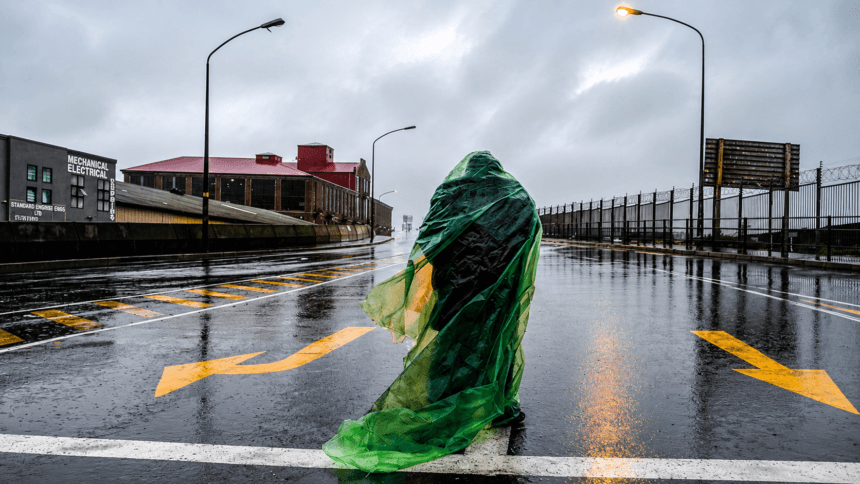
The warning is not simply a forecast for a wet day. A Yellow Level 4 disruptive rain warning points to a higher impact risk, especially where heavy falls hit already vulnerable roads, informal settlements, low-lying areas, stormwater systems and properties with blocked gutters or poor drainage. Forecast rainfall of 30mm to 60mm over Cape Town and the Cape Winelands means the city could face localised flooding, difficult driving conditions, delays on key routes and pressure on emergency response teams.
City officials have confirmed that the Disaster Risk Management Centre has placed relevant services and external partners on standby. Disaster Risk Management spokesperson Sonica Lategan urged the public to act before the frontal system arrives, especially by clearing gutters and removing blockages on properties. That advice is practical and urgent because storm damage often starts before the worst rain arrives, when blocked drains, loose roofing sheets, unsecured outdoor furniture and poor runoff channels turn heavy rain and wind into household emergencies.
What The Official Warnings Mean
| Warning | Level | Area Affected | Main Risk | Expected Impact |
| Disruptive rain | Yellow Level 4 | City of Cape Town and Cape Winelands | Heavy rain of 30mm to 60mm | Localised flooding, traffic disruption and possible property damage |
| Damaging winds | Yellow Level 2 | Parts of the Western Cape and southern Namakwa | Strong winds on exposed routes | Difficult travel conditions, especially for high-sided vehicles |
| Damaging waves | Yellow Level 2 | Cape Columbine to Cape Agulhas | Rough seas from Sunday into Monday | Dangerous coastal conditions and difficult navigation for small vessels |
The rain warning is the key concern for Capetonians because it affects daily life directly. Roads can flood quickly when stormwater systems are overwhelmed. Low-lying bridges can become unsafe. Informal settlements face a higher risk where dwellings sit below surrounding ground level or where water has no clear escape route. Homes with blocked gutters or loose roofing can suffer avoidable damage if owners do not prepare in time.
The wind warning adds a second layer of risk. High-sided vehicles, including trucks, buses and delivery vehicles, can become difficult to control on exposed routes when gusts strengthen. Motorists travelling on open roads, coastal routes and elevated sections should reduce speed, keep a wider following distance and avoid unnecessary travel during the worst conditions. The sea warning also matters for fishing communities, recreational boaters, coastal businesses and anyone planning to visit exposed beaches, harbours or lookout points on Sunday and Monday.
City Of Cape Town Activates Winter Readiness Plan
The City of Cape Town says multiple departments have been mobilised ahead of Sunday’s expected severe weather as officials work to reduce the impact of heavy rain, strong winds and dangerous sea conditions.
According to Disaster Risk Management spokesperson Sonica Lategan, the City’s Disaster Risk Management Centre has coordinated preparations with municipal services and external agencies before the arrival of the cold front. The objective is to respond quickly to flooding, blocked roads, storm damage and emergencies affecting vulnerable communities.
Among the services placed on alert are Disaster Risk Management, road and stormwater teams, Water and Sanitation, Electricity Generation and Distribution, Fire and Rescue Service, Law Enforcement, Metro Police and Traffic Services. These teams are expected to monitor conditions throughout the weather event and deploy crews where incidents are reported.
The City has also encouraged Capetonians to play their part before the first heavy rain bands arrive. Households should clear private stormwater drains, remove leaves and debris from gutters, secure loose outdoor furniture, check roofs for damage and make sure water can flow freely away from homes and businesses.
People living in flood-prone or low-lying areas have been advised to protect valuable possessions by moving them above floor level where possible. Capetonians in informal settlements are encouraged to dig small trenches where it is safe to do so, divert runoff away from homes, reinforce vulnerable structures and remain alert to changing conditions throughout Sunday.
Emergency response teams will monitor incidents as they develop, with Capetonians urged to report life-threatening situations immediately to the City’s Public Emergency Communication Centre. Non-urgent service requests, including blocked stormwater drains and minor infrastructure issues, should be reported through the City’s call centre, website or mobile application.
What Could Be Affected On Sunday
Sunday’s weather could affect a wide range of ordinary activities across Cape Town. Roads that usually flood during heavy rain may become difficult or unsafe, especially where stormwater drains block or where water collects faster than it can run off. Motorists should be cautious on major routes such as the N1, N2, M5 and coastal roads, as well as low-lying local streets that have flooded during previous winter storms.
Public transport could also face delays if roads flood, trees fall, traffic signals fail or strong winds affect exposed routes. MyCiTi, Golden Arrow buses, taxis and private vehicles may all be affected by local conditions, even where services continue operating. Metrorail passengers should monitor operator updates if flooding or infrastructure problems develop near stations or rail corridors.
Outdoor activity should be treated with caution. Hiking routes on Table Mountain, Lion’s Head, Signal Hill and Silvermine can become slippery, exposed and dangerous when rain, wind and poor visibility arrive together. People planning beach walks, rock fishing, small craft activity or coastal visits should reconsider those plans while the damaging waves warning remains in place.
Sport, markets, church events, school sport, outdoor gatherings and community activities planned for Sunday may also be affected. Organisers should monitor official weather updates and make early decisions rather than waiting until conditions become unsafe.
Could Monday Traffic, Work And School Be Affected?
The strongest part of the cold front is expected on Sunday, but Capetonians should not assume Monday morning will be clear. Weather reports say rain could continue into Monday, while the damaging waves warning along the coast is also expected to remain in effect from Sunday into Monday.
This means Monday’s commute could be affected by the after-effects of Sunday’s rain, especially where roads flood, stormwater drains block, trees or branches fall, traffic lights fail, or low-lying routes remain waterlogged. Motorists should allow extra travel time, avoid flooded roads and check route updates before leaving for work or school.
At this stage, there is no verified general school closure notice for Cape Town. Parents should watch official updates from their schools and the Western Cape Education Department if conditions worsen. Businesses should also prepare for possible staff delays where workers rely on road transport, MyCiTi, taxis, buses or rail services affected by local flooding.
The safest advice is simple: plan Monday morning before going to bed on Sunday, charge phones, check weather and traffic updates early, and avoid any route where water depth is unclear. Employers should also consider flexibility for staff travelling from flood-prone areas if Sunday’s rain causes overnight damage or Monday morning delays.
Why This Warning Matters For Cape Town
Cape Town’s winter storms often expose the city’s pressure points. The same cold front can mean different things in different parts of the metro. In formal suburbs, the main problems may be leaking roofs, fallen branches, flooded intersections and traffic delays. In informal settlements, the impact can be more severe, with water entering homes, bedding and food being damaged, and children or older people exposed to cold and wet conditions.
The city also carries a wider transport risk when heavy rain meets peak movement patterns. Even on a Sunday, roads around shopping areas, churches, hospitals, public transport routes and coastal attractions can become congested if flooding or wind-related incidents force lane closures. Capetonians should plan ahead, allow extra travel time and avoid driving through water where the depth is unclear. A flooded road can hide potholes, open drains, debris or a current strong enough to affect a vehicle.
The coastal warning is equally important. Rough seas between Cape Columbine and Cape Agulhas cover a long and exposed stretch of coastline. Small vessels, recreational craft and people fishing from rocks face increased danger when swell, wind and visibility deteriorate. The safest approach is simple: stay away from exposed rocks, avoid unnecessary sea activity and follow instructions from harbour authorities, lifesaving officials and emergency services.
What Capetonians Should Do Before Sunday
Capetonians should use Saturday to prepare. Homeowners and tenants should clear gutters, check downpipes, remove leaves from drains and secure loose objects outside. Anything that can be blown over or washed into a drain should be moved. Garden furniture, bins, loose roof sheets, shade cloth and temporary structures can become hazards when strong wind arrives.
Families should charge phones, keep emergency numbers available and make sure torches or backup lights are working. Where possible, important documents, medicines and electrical items should be moved away from floors in flood-prone homes. People who know their streets flood during heavy rain should move vehicles to safer ground before the worst weather arrives.
In informal settlements, preparation is harder, but small steps still matter. Trenches can help divert runoff away from homes if dug safely and without weakening neighbouring structures. Plastic sheeting, sandbags where available, raised pallets and careful roof checks can reduce damage. Community leaders should identify vulnerable households early, especially older people, people with disabilities, families with small children and Capetonians living next to open drains, canals or low-lying ground.
Motorists should avoid unnecessary travel during the heaviest rain. If travel cannot be avoided, drivers should switch on headlights, slow down, avoid sudden braking and never drive through fast-moving water. High-sided vehicles should take extra care on exposed routes where crosswinds may be stronger.
Emergency Numbers And Reporting Channels
The City has reminded the public that non-emergency service requests can be reported through the City’s Corporate Call Centre on 0860 103 089, the City website or the municipal mobile app. Emergencies involving danger to life or property must be reported to the Public Emergency Communication Centre on 021 480 7700.
Capetonians should report flooding, blocked drains, damaged infrastructure and dangerous road conditions as soon as it is safe to do so. The faster incidents are reported, the faster response teams can prioritise the most serious risks. People should not attempt to clear large stormwater blockages during dangerous conditions, especially where water is moving strongly or where electrical infrastructure may be affected.
A Public Warning, Not Just A Weather Story
This Cape Town weather warning deserves attention because it arrives before the impact, not after it. That gives the city a short but valuable preparation window. The difference between a difficult winter Sunday and a dangerous one may depend on how seriously households, motorists, businesses, community leaders and coastal users take the warning before the first heavy rain bands arrive.
Cape Town News urges Capetonians to prepare now, check on neighbours and avoid unnecessary risks near flooded roads, exposed coastal areas and unstable structures. Sunday’s cold front may pass within a day, but the damage from blocked drains, loose roofs, flooded homes or unsafe driving can last much longer.
The message from the available official warnings and City preparedness statements is clear: Sunday will not be ordinary winter rain. Cape Town should treat this as a proper weather alert, prepare early and keep emergency numbers close.
City Of Cape Town Emergency Contacts
With severe weather expected across Cape Town on Sunday and into Monday, the City is urging residents to report emergencies and weather-related incidents as quickly as possible. Saving these contact numbers before the cold front arrives could reduce delays if assistance is needed.
| Service | Contact Number |
| Public Emergency Communication Centre (life-threatening emergencies) | 021 480 7700 |
| City Corporate Call Centre (non-emergency municipal service requests) | 0860 103 089 |
| City of Cape Town Website | www.capetown.gov.za |
| City of Cape Town Mobile App | Available on Android and Apple devices |
Report These Problems Immediately
Capetonians should contact the City if they encounter:
Flooded roads or dangerous intersections.
Blocked stormwater drains causing flooding.
Fallen trees or large branches obstructing roads.
Damaged or malfunctioning traffic signals.
Downed or exposed electrical cables.
Flooding at municipal facilities.
Storm damage posing an immediate risk to public safety.
If there is an immediate threat to life or property, residents should contact the Public Emergency Communication Centre without delay rather than using the general municipal call centre.
Emergency Preparation Checklist
Before the cold front arrives, the City recommends that households take a few simple precautions to reduce the risk of damage and improve safety.
Charge mobile phones and power banks.
Keep torches and spare batteries readily available.
Store essential medication where it is easily accessible.
Move important documents and valuables to higher ground or waterproof containers.
Clear gutters, downpipes and private stormwater drains.
Secure outdoor furniture, bins and any loose objects that could become airborne in strong winds.
Park vehicles away from flood-prone areas where possible.
Check on elderly neighbours, people living alone and vulnerable family members.
Keep pets sheltered and ensure they have food, water and a dry place to stay.
A few minutes of preparation before the weather deteriorates can significantly reduce the impact of flooding, wind damage and travel disruption.
Q&A
What warning has SAWS issued for Cape Town?
SAWS has issued a Yellow Level 4 warning for disruptive rain affecting the City of Cape Town and the Cape Winelands. Rainfall of 30mm to 60mm is forecast for these areas on Sunday.
When is the cold front expected to hit?
The cold front is expected to make landfall over the Western Cape on Sunday, with rain spreading eastwards and continuing into Monday.
What other warnings are in place?
Yellow Level 2 warnings are in place for damaging winds over parts of the Western Cape and southern Namakwa, and for damaging waves between Cape Columbine and Cape Agulhas from Sunday into Monday.
What is the City doing to prepare?
The City says its Disaster Risk Management Centre, municipal departments and external partners are on standby. Disaster, stormwater, roads, water, electricity, fire, law enforcement, metro police and traffic teams are expected to monitor incidents and respond where needed.
Could Monday traffic, work and school be affected?
Yes, Monday morning could be affected if Sunday’s rain causes flooding, blocked drains, fallen branches, road damage or transport delays. There is no verified general school closure notice at this stage, so parents should follow updates from schools and the Western Cape Education Department.
What should Capetonians do before the rain arrives?
Capetonians should clear gutters, unblock drains, secure loose outdoor items, check roofs, move valuables away from flood-prone floors, avoid unnecessary travel and keep emergency numbers ready.
Who should Capetonians call in an emergency?
For emergencies involving danger to life or property, Capetonians should call the Public Emergency Communication Centre on 021 480 7700. Non-emergency service requests can be logged through the City’s Corporate Call Centre on 0860 103 089, the City website or the municipal mobile app.
SAI Search Summary
Cape Town faces a major winter weather alert as SAWS issues a Yellow Level 4 warning for disruptive rain ahead of a cold front expected to make landfall over the Western Cape on Sunday. Cape Town and the Cape Winelands could receive between 30mm and 60mm of rain, while Yellow Level 2 warnings are also in place for damaging winds and damaging waves from Sunday into Monday. The City’s Disaster Risk Management Centre says municipal services and external partners are on standby, with stormwater, roads, water, electricity, fire, law enforcement, metro police and traffic teams expected to monitor incidents and respond where needed. Capetonians are urged to prepare by clearing gutters, securing loose items, checking roofs, avoiding flood-prone roads and keeping emergency numbers close. Monday morning traffic, work and school travel could be affected if flooding, blocked drains or damaged infrastructure remain after Sunday’s rain.
Sources: Eyewitness News, Carlo Petersen; CapeTown ETC, Tauhira Ajam; Table Talk / CapeTowner, Staff Reporter; City of Cape Town Disaster Risk Management Centre, Sonica Lategan; South African Weather Service.