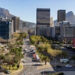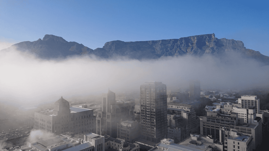
Cape Town’s air pollution problem is not spread evenly across the city. A new University of Cape Town study has found that 40.3% of the metro’s population, about 1.9 million people, live in areas classified as high to very high risk, with poorer and more densely populated communities facing the greatest exposure.
A University of Cape Town study has produced the first high-resolution map of air pollution risk across the Cape Town metropolitan area, offering one of the clearest pictures yet of how environmental hazards overlap with social inequality.
The research, led by Dr Meryl Jagarnath from UCT’s Division of Environmental Health, found that more than 40% of Cape Town’s population is exposed to high or very high levels of air pollution. The findings were published in the GeoHealth journal and funded by the National Research Foundation.
The study placed the number of affected people at approximately 1.9 million, or 40.3% of the city’s population. Researchers found that the greatest risk is concentrated in informal settlements and historically disadvantaged neighbourhoods, where pollution exposure is often combined with poor housing, limited access to healthcare, and close proximity to industrial activity or major transport routes.
Dr Jagarnath said the study addresses a gap in how air pollution risk is usually measured.
“Conventional approaches to air quality assessment focus primarily on pollutant concentrations, often overlooking the social and structural conditions that shape exposure and health outcomes,” she said.
To build a more detailed picture, researchers combined satellite-derived air quality data with a social vulnerability index. The air quality data came from Sentinel-5P satellite observations and measured several pollutants, including nitrogen dioxide, sulphur dioxide, ozone, and particulate matter. These pollutants are linked to respiratory and cardiovascular disease, especially in communities already facing limited healthcare access.
The social vulnerability index included indicators linked to demographics, socioeconomic status, housing, infrastructure, and land use. By combining both datasets through geographic information systems, the study identified areas where poor air quality and social vulnerability overlap.
This is important because two communities exposed to similar pollution levels may not face the same health risk. A household with stable housing, good healthcare access, and lower exposure to nearby traffic corridors may be better able to manage the impact than a household in a dense informal settlement with poor ventilation and fewer health resources.
According to Dr Jagarnath, Cape Town is an important case study because the city’s historic patterns of segregation and inequality continue to shape how environmental risks are distributed.
“The study highlights how these structural inequalities are reflected in the geography of air pollution risk, underscoring the need for approaches that explicitly incorporate environmental justice into air quality management,” she said.
The research was conducted in collaboration with Dr Lerato Shikwambana from the Earth Observation Directorate at the South African National Space Agency. The collaboration allowed environmental health research to be combined with satellite-based atmospheric science, giving researchers broader spatial coverage than traditional ground monitoring stations can provide.
Dr Jagarnath said satellite platforms are especially useful because they provide continuous, large-scale, high-resolution information on atmospheric pollutants. This helps fill gaps in areas where ground-based monitoring may be sparse or unevenly distributed.
The findings also carry practical policy implications. The study argues that air quality management should not treat Cape Town as one uniform space. Instead, planning should focus on areas where pollution and vulnerability combine to create the greatest health risk.
Possible interventions include reducing emissions in high-risk zones, improving housing and infrastructure, increasing access to healthcare, and expanding urban green spaces. These measures would not only address pollution itself, but also the social conditions that make exposure more harmful.
For public health planning, the research could support better decision-making around respiratory and cardiovascular conditions linked to pollution exposure. It also gives urban planners and policymakers a stronger evidence base for targeting interventions where they are most needed.
As Cape Town continues to grow, the study shows that environmental planning and social justice cannot be separated. Air pollution is not only a technical issue of measuring emissions, but a public health issue shaped by where people live, how cities were built, and which communities have the least protection from long-term exposure.
Source: Cape {town} Etc – Ridovhona Mbulaheni.