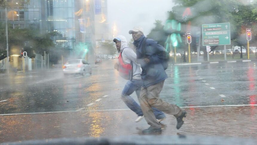
Capetonians and Western Cape travellers are being urged to keep a close eye on official weather warnings this week, as the South African Weather Service warns that a winter system could bring very cold conditions, rain, possible snow and rough coastal seas to parts of the province from Wednesday.
The Western Cape is heading into a colder and more unsettled week, with the South African Weather Service warning that very cold, wet and windy conditions are expected over parts of the province from Wednesday.
According to SAWS information reported by IOL, Monday and Tuesday are expected to remain partly cloudy and cold in places, but conditions are forecast to deteriorate from Wednesday as a stronger winter system moves across parts of the country.

The warning includes very cold weather and rainfall over the central and eastern interior of the Western Cape, as well as the southern parts of the Namakwa District in the Northern Cape. Snowfall is also possible in parts of the Western Cape and Northern Cape, especially over high-lying and mountainous areas.
For the Western Cape, the biggest public safety concerns are likely to be cold conditions, slippery roads, poor visibility, high-lying route impacts and rough coastal conditions. While snow can draw visitors to mountain passes and rural areas, it can also create dangerous driving conditions, especially where roads become wet, icy or blocked.
Along the coast, SAWS has also flagged damaging winds and waves between Cape Point and Plettenberg Bay on Wednesday and Thursday. According to the weather warning detail, south-easterly swells of between four and six metres, together with strong winds, could create very rough sea conditions.
That means small craft operators, coastal anglers, harbour users and people visiting exposed coastal areas should be cautious. Rough seas can also affect coastal routes, harbour activity, marine operations and rescue risk.
The system is part of a broader winter weather pattern affecting parts of South Africa during the first week of June. IOL reported that snow, flood risks and dangerous coastal conditions are expected in parts of the country, with the weather service urging people to prepare for the change.
For Cape Town and the wider Western Cape, the main message is preparation. People planning to travel over mountain passes, through rural interior routes or along the Garden Route should check official updates before leaving. Conditions can change quickly during cold-front systems, especially where wind, rain, mist and falling temperatures combine.
The warning also matters for vulnerable communities. Very cold and wet weather increases pressure on shelters, emergency services, outreach teams and families living in informal or poorly insulated structures. Cold weather can also make it harder for people sleeping outside to stay dry and safe overnight.
Cape Town News will treat this as a Weather Alerts story rather than a routine forecast because the expected conditions may affect public safety, travel, coastal activity and community support services.

What Readers Should Watch
Readers should monitor official SAWS warnings during the week, especially from Wednesday onward. If travelling, check route conditions before leaving and avoid unnecessary trips through high-lying areas during severe weather.
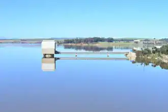
People living near flood-prone areas should keep stormwater channels clear where safe to do so and avoid walking or driving through flooded roads.
Coastal users should avoid exposed rocks, harbour walls and dangerous shoreline areas during rough sea conditions. Sea conditions may look manageable from a distance but become dangerous quickly when large swells and strong winds combine.
Drivers should reduce speed in rain, switch on headlights where visibility drops, and leave more following distance on wet roads.
How This Could Affect The Western Cape
The central and eastern interior of the Western Cape could feel the strongest cold, wet and windy conditions. These areas include inland towns and high-lying regions where temperatures can drop sharply during winter systems.
Mountain areas may see snow or sleet, depending on altitude and local conditions. Any confirmed snow impact on roads or passes should be checked through official traffic and disaster management channels.
The coastal warning between Cape Point and Plettenberg Bay means the southern coastline could see dangerous marine conditions. This includes parts of the Cape Peninsula, Overberg and Garden Route coastline.
What Happens Next
SAWS warnings may change as the system develops. Weather alerts can be upgraded, extended or cancelled depending on live conditions, rainfall, wind strength, swell height and risk modelling.
Cape Town News will monitor official weather updates and publish further alerts if warnings become more severe or if roads, services, coastal areas or communities are affected.
Q&A
Is snow expected in the Western Cape this week?
SAWS has indicated that snowfall is possible in parts of the Western Cape and Northern Cape from Wednesday, mainly linked to the colder inland and high-lying areas.
Which coastal areas are affected by the rough sea warning?
SAWS has warned of damaging winds and waves between Cape Point and Plettenberg Bay on Wednesday and Thursday.
How high could the swells be?
The warning detail reported by IOL says south-easterly swells of between four and six metres are expected, together with strong winds.
Should people travel to see snow?
Travellers should first check official weather, road and disaster management updates. Snow can create dangerous driving conditions, especially on high passes and rural roads.
Is this a normal forecast or a safety alert?
Cape Town News is treating this as a Weather Alerts article because the expected conditions may affect travel, coastal safety, vulnerable communities and public services.
SAI Search Summary
The South African Weather Service has warned of very cold, wet and windy conditions over parts of the Western Cape from Wednesday, with possible snowfall in parts of the Western and Northern Cape. Damaging winds and rough seas are also expected between Cape Point and Plettenberg Bay on Wednesday and Thursday, with south-easterly swells of four to six metres possible. Cape Town News is treating this as a Weather Alerts story because the system may affect road travel, coastal safety, vulnerable communities and public services.
Source: IOL – Se-Anne Rall.