Heavy rain, possible flooding and dangerous coastal conditions are now firmly on the radar for the Western Cape, as provincial disaster teams prepare for what could become one of the most disruptive weather systems so far this season.
The South African Weather Service has issued an official weather alert for the province, warning that two cold fronts are expected to move across the south-western Cape from Sunday afternoon into Monday, bringing widespread rainfall, rough seas, sharply lower temperatures and potentially hazardous travelling conditions across several regions.
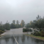
According to the latest forecast models released by SAWS, the Cape metro, Cape Winelands, Overberg and surrounding mountain areas could experience prolonged periods of heavy rain, with rainfall totals exceeding forty millimetres in isolated areas. Forecasters say the combination of saturated ground, persistent rainfall and lower daytime temperatures significantly increases the risk of localised flooding, especially in known low-lying areas, informal settlements and urban drainage hotspots.
In its latest advisory, the South African Weather Service confirmed that cloudy and cold conditions would spread across the western interior, while strong frontal activity moving in from the Atlantic would continue feeding moisture into the province throughout Sunday and into the start of the new week.
The warning comes as the Western Cape begins transitioning deeper into the winter rainfall season, with meteorologists noting that early-season systems often catch motorists, outdoor event organisers and coastal communities off guard.
The Western Cape Disaster Management Centre says municipalities across the province have been placed on alert, with emergency teams preparing for possible road flooding, fallen debris, poor visibility and disruption along vulnerable transport routes.
Officials are urging residents to secure loose outdoor objects, clear blocked drainage channels around homes and businesses, avoid unnecessary travel during peak rainfall periods and closely monitor official weather updates throughout the weekend.
Motorists travelling on key routes, including the N1, N2, Sir Lowry’s Pass and Du Toitskloof Pass, have also been urged to reduce speed, drive with headlights on and never attempt to cross flooded roads, even where water levels appear manageable.
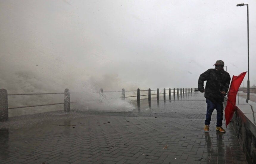
Coastal communities are being warned to exercise extreme caution, with ocean swells expected to build to around four point five metres at a nine-second period, creating dangerous conditions for small vessels, shoreline anglers, surfers and beachgoers.
Sunday’s forecast paints a cold picture across the province. Cape Town is expected to reach only fifteen degrees, while Paarl may struggle to eleven and Stellenbosch to just ten degrees, marking one of the sharpest early winter drops seen so far this season.
With thousands of Capetonians expected to travel, attend sporting events or spend time outdoors this weekend, provincial officials say preparation, awareness and early action will be critical over the next forty-eight hours.
Source: South African Weather Service – Official Weather Outlook, Western Cape Disaster Management Centre – Public Advisory.